SAR-OPS
Search and rescue operations
The first hour decides the whole search.
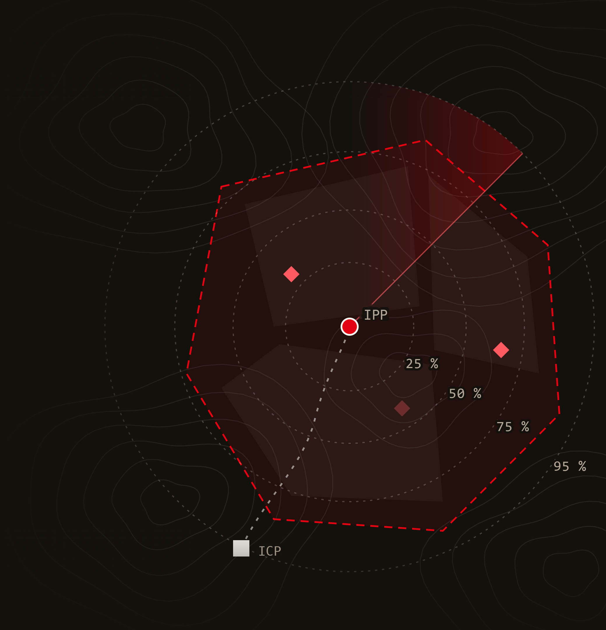
Collect the missing person's information, get a probable search area, generate the tasks, order and prioritise them by statistics and put them on each team's phone with a QR code or a WhatsApp message.
From the call to the report, on the same screen
Why it exists
In a search, what fails is almost never the willingness.
01
Planning drags on
Maps on the hood of a car, crossed phone calls and decisions that depend on who is on duty that night. While decisions are being made, nobody is searching.
02
Information arrives half-complete
What they were wearing, what they took, who they were with, what medication they need. If it isn't asked well and early, it can't be recovered.
03
Reports arrive late, or not at all
When the operation ends, the team is exhausted. The report ends up as four notes and the memory of three people.
04
The archive gets lost
Without an organised history there is no follow-up and no review, and every search starts again from scratch.
None of it is a people problem. All of it is a tools problem.
SAR-OPS
The problem
Origin
This wasn't designed in an office.
SAR-OPS comes from standing in the field with the dog ready, waiting for the assignment to arrive while the first hour burns away.
None of that is fixed by running faster. It is fixed with a tool that already knows what to ask, what to calculate and what to hand each team.
“
Every minute gained on the map is one more minute of searching in daylight.
Made by people who search.
Origin
How it works
From the call to deployment, in six steps.
The same order any operation follows, without the dead time between one step and the next.
01
Open the operation
Location and number of missing people. The rest writes itself.
02
Collect the information
Full profile of the missing person and of each reporting party.
03
Calculate urgency and area
Statistical rings, real terrain and weather for the area.
04
Generate the tasks
By sectors or along paths, prioritised by statistics.
05
Deploy with a QR code
Each team takes its dossier and GPX route, and uploads its track on the way back.
06
Track and close
Runs, tracks, clues and findings. When you close, the report is already written.
SAR-OPS
How it works
Step 1 · Open the operation
Opening an operation takes two pieces of data.
NEW OPERATION
Basic data
Location
Collado Norte, Sierra de Guadarrama
Victims
2
Names
Lucía M. · Andrés R.
SUMMARY · WRITTEN BY AI
Operation Collado Norte
Search for two hikers not located after starting a route through Collado Norte. It can be edited now or later.
Location and number of missing people
With that the operation already exists and you can start working on it.
Name and description, written for you
AI writes them from the data so you can get on with what matters.
Active, on hold or closed
An operation is paused, closed and reactivated whenever needed, without losing anything.
SAR-OPS
Step 1 · Create
Step 2 · Collect the information
A profile that leaves nothing out.
Basic data
Name, nickname, ID document, date of disappearance, language and punctuality
Physical description
Age, gender, height, weight, skin, hair, facial hair and photo
Clothing
Item by item: brand, colour, size and style. Even the sole pattern
Incident
Last sighting, activity, planned and alternative destination and route
Vehicle and animal
Type, description, tyres, tracker and accompanying animal
Equipment and experience
Water, food, light, warm clothing, GPS, beacon, walkie-talkie… and whether they know the area
Health
Physical condition, injuries, allergies, medication, mobility, sight and hearing
Mental health
Dementia, autism, depression, substance use, recent events and risk level
REPORTING PARTIES
Each reporting party with their phone number, ID, relationship to the missing person and reason for the report.
SAR-OPS
Step 2 · Information
Step 2 · AI support
AI does the desk work.
01
Operation name and description
Written from the location and the missing people.
02
Physical and clothing description
A clear text built from the profile fields, so everyone searches for the same thing.
03
Categories that fit
Reads the planned activity and suggests plausible categories. If the one chosen doesn't match, it warns you.
04
Reference image of the scene
With the clothing, vehicle, animal and photo if there is one. Only when there is enough detail, and without intimate details.
WHAT DOESN'T DEPEND ON AI
Urgency, area and tasks come from statistics and calculation.
With the same data they always give the same result. What AI writes is reviewed and edited before use.
If AI doesn't respond, you are notified and everything else keeps working.
SAR-OPS
Step 2 · AI

Step 3 · Assess urgency
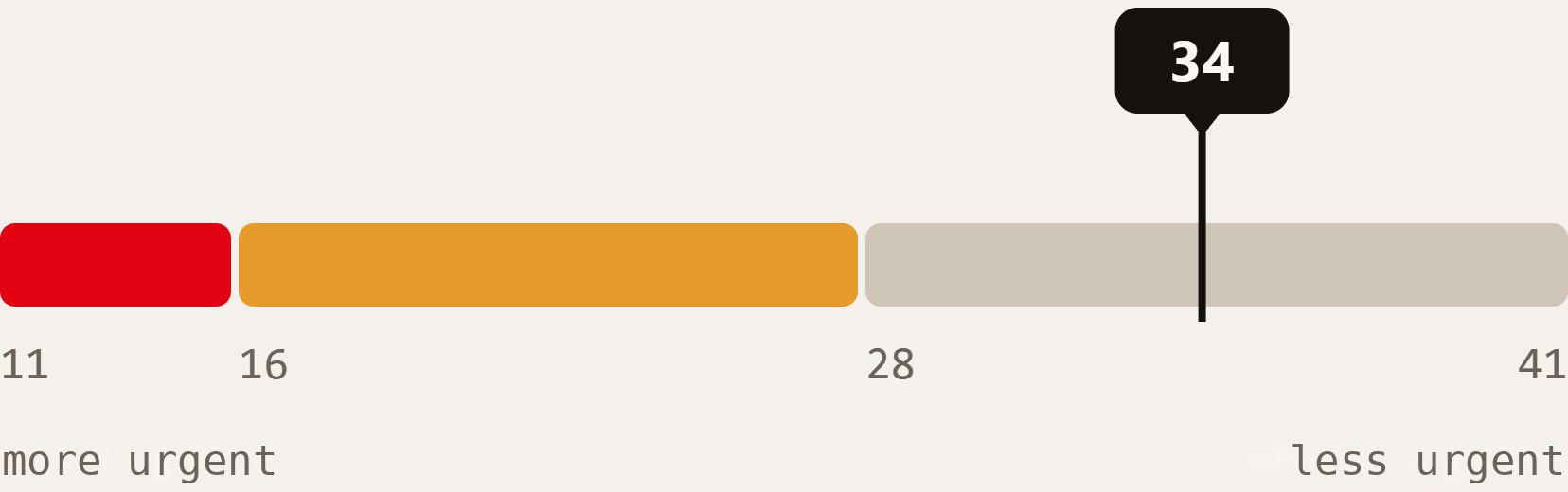
Urgency, in one clear answer.
Eleven factors about the missing person and the environment. Most fill in automatically from the profile and the real weather forecast for the area.
Age
Medical condition
Punctuality
Physical condition
Experience and area
Clothing
Equipment
Circumstances
Weather
Terrain and hazards
People and separation
Urgent response
11–15
Moderate response
16–27
Investigate and assess
28–41
SAR-OPS
Step 3 · Urgency
Step 3 · Calculate the area
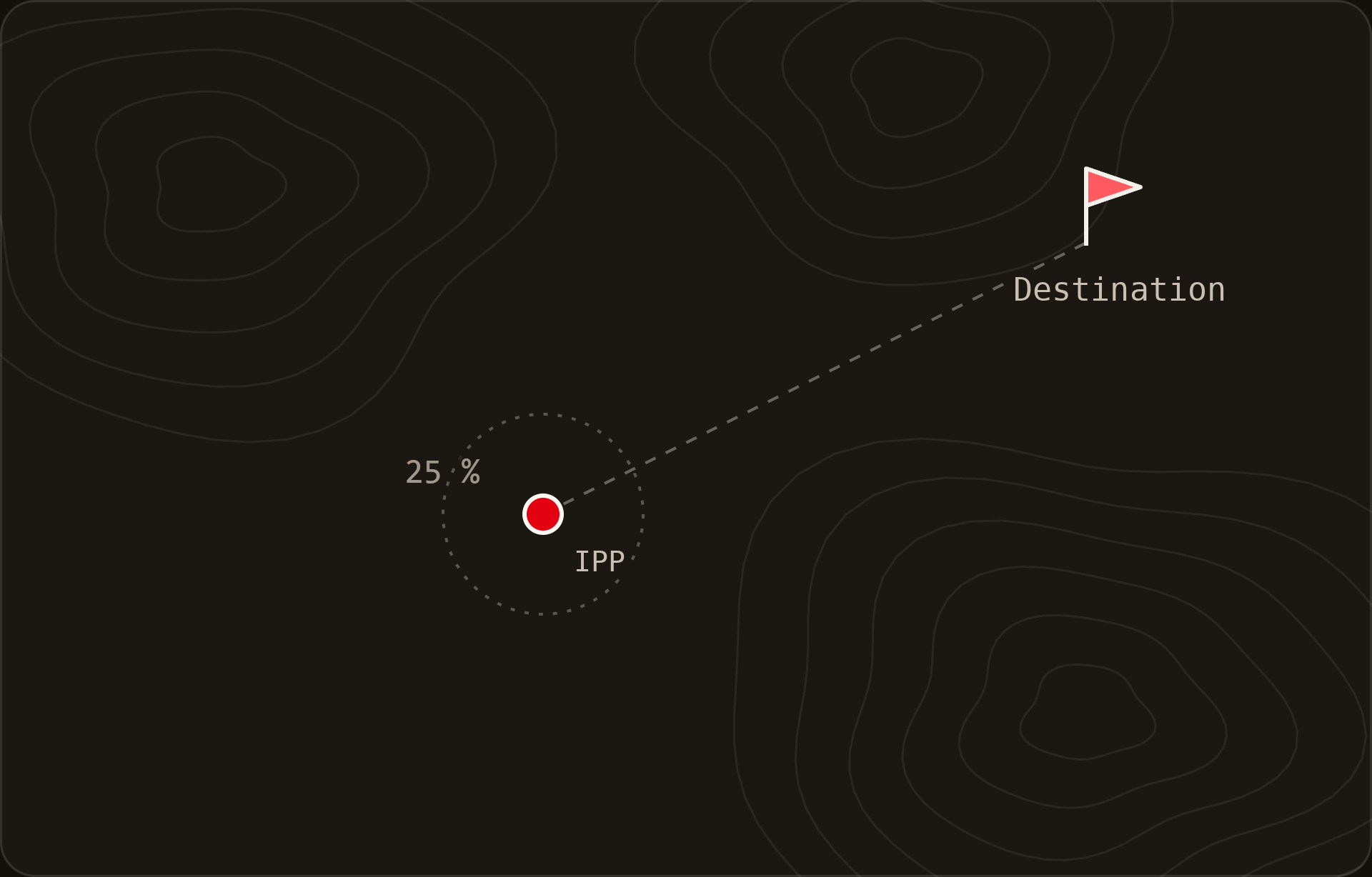
The probable area comes from statistics.
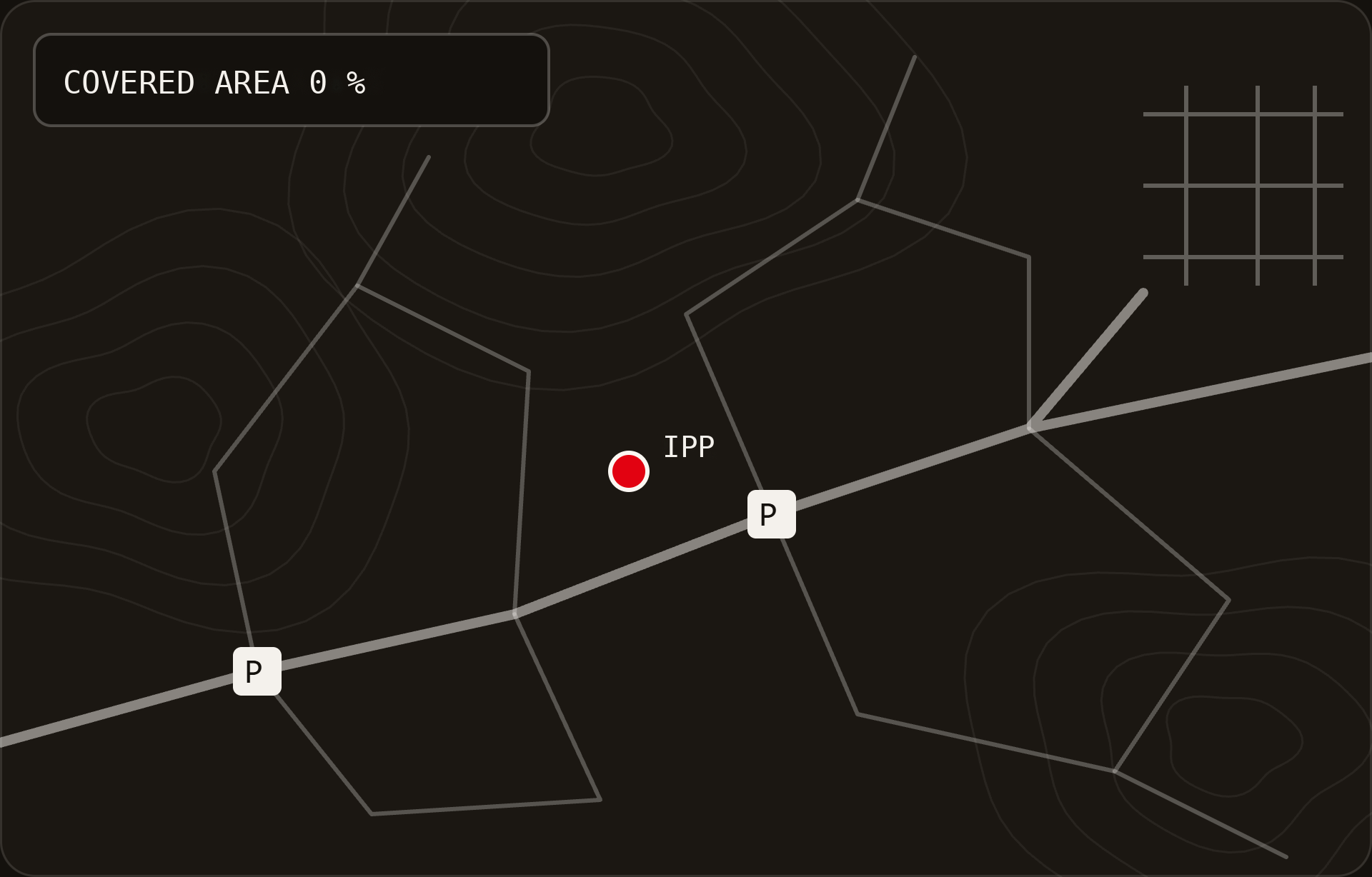
Probability rings from the IPP depending on who is lost and where, oriented towards their destination.
32 CATEGORIES
Hiker, hunter, forager, child aged 4 to 6, dementia, 4x4 vehicle…
REAL TERRAIN
Local climate and mountainous or flat relief, deduced from the real elevation.
COVERAGE OF YOUR CHOICE
Draws the area that covers the percentage you decide, or calculates how much the one you draw covers.
A statistical estimate: always reviewed with operational judgement.
SAR-OPS
Step 3 · Area
Step 3 · Operation map
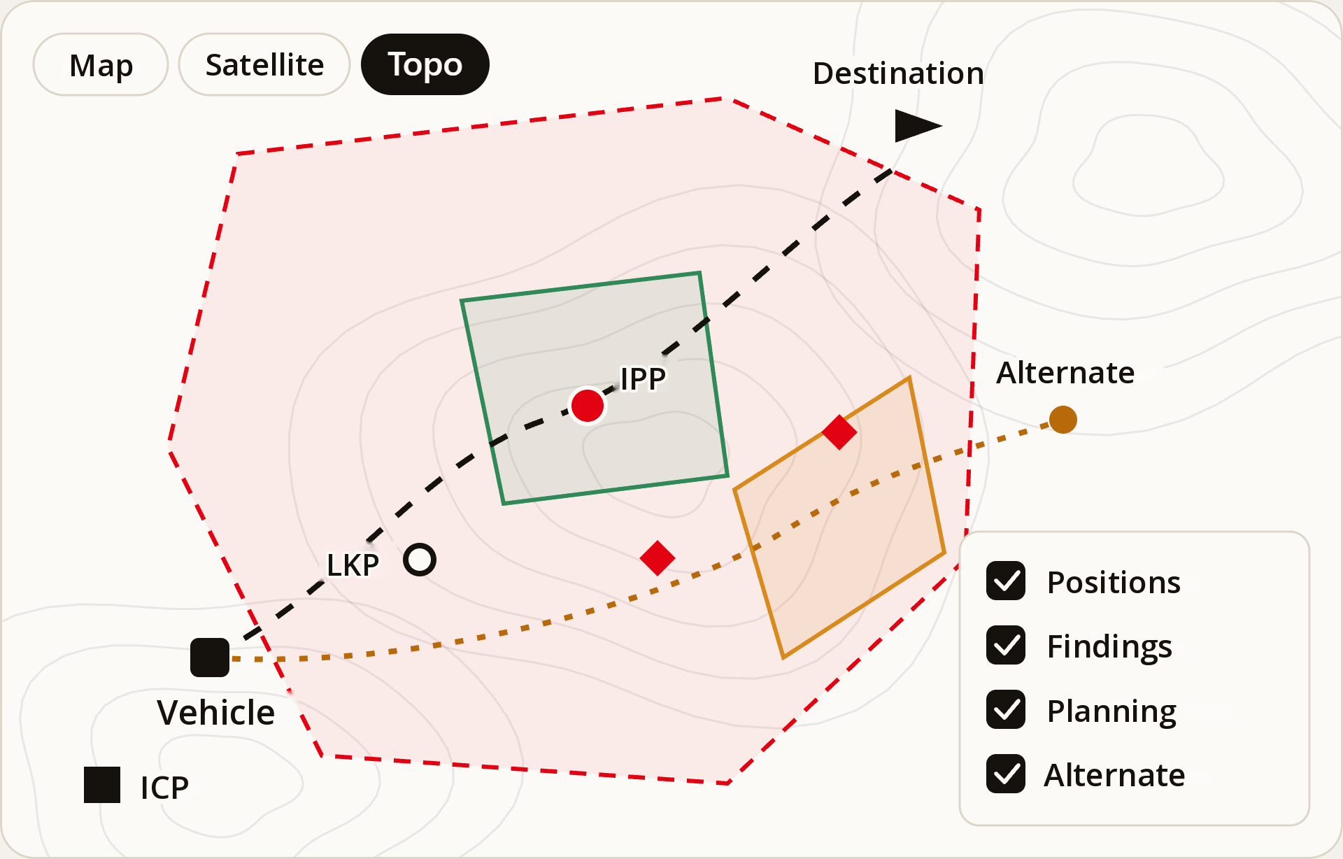
The whole operation, on one map.
WHAT GETS MARKED
- IPP and ICP, the latter at your current position
- Last sighting and last known position
- Planned and alternative destinations and routes
- Vehicle, clues and findings
- Search area, tasks and team tracks
WITH WHAT
- Map, satellite and topographic
- Areas and routes drawn or imported as GPX
- Distance and coordinate measurement
- Place search by name
- Layers you hide with one click
SAR-OPS
Step 3 · Map
Step 4 · Generate the tasks
Tasks are generated from the map.
MINIMAL
What can't wait
- Thorough search at the IPP and at each destination
- Mirror of each planned and alternative route
- Radii based on the missing person's statistics
QUICK SEARCH
All terrain, along paths
- Sweeps along paths, tracks and roads
- Villages turned into area tasks
- In batches, with the % of the area already covered
SECTOR SEARCH
All terrain, in sectors
- Sectors with natural limits
- Each one with its probability
- Also with villages and in batches
AVAILABLE RESOURCES
Trailing dogs
Air-scent dogs
Signcutters
Drones
Aerial assets
Each task recommends which resource to deploy, and with aerial assets a reconnaissance of the whole area is added.
SAR-OPS
Step 4 · Tasks

Step 4 · Quick search
Sweeps a team can walk.
ON FOOT
Loops that return to where the car is left. The way back counts: 4 km per sweep, or whatever you choose.
BY VEHICLE
Open routes, 25 km by default, that respect one-way streets.
BY PRIORITY
Starts with the terrain closest to the IPP and doesn't repeat what another task already covers.
NO SURPRISES
A classic route-allocation method, no AI: same data, same allocation.
SAR-OPS
Step 4 · Sweeps
Step 4 · Sector search
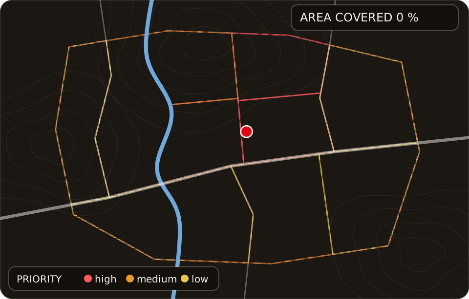
Sectors a team can comb.
LIMITS NOBODY CROSSES
Rivers, canals, motorways, railways and cliffs stay on the edge, never in the middle: they can't be crossed on foot.
ONE SHIFT PER SECTOR
0.5 km² by default, what a team of five combs in a shift. Compact sectors, no corridors, and no sea or reservoirs.
WHERE TO PARK
Each sector says where to leave the car: on tarmac if there is any, and if it means a dirt track, it warns that a 4x4 is needed.
WITH ITS PROBABILITY
Each sector carries its own, and the ones with the most per km² go first.
SAR-OPS
Step 4 · Sectors
From tasks to deployment
From the call to the first team deployed without leaving the same screen.
Step 5 · Deploy the team
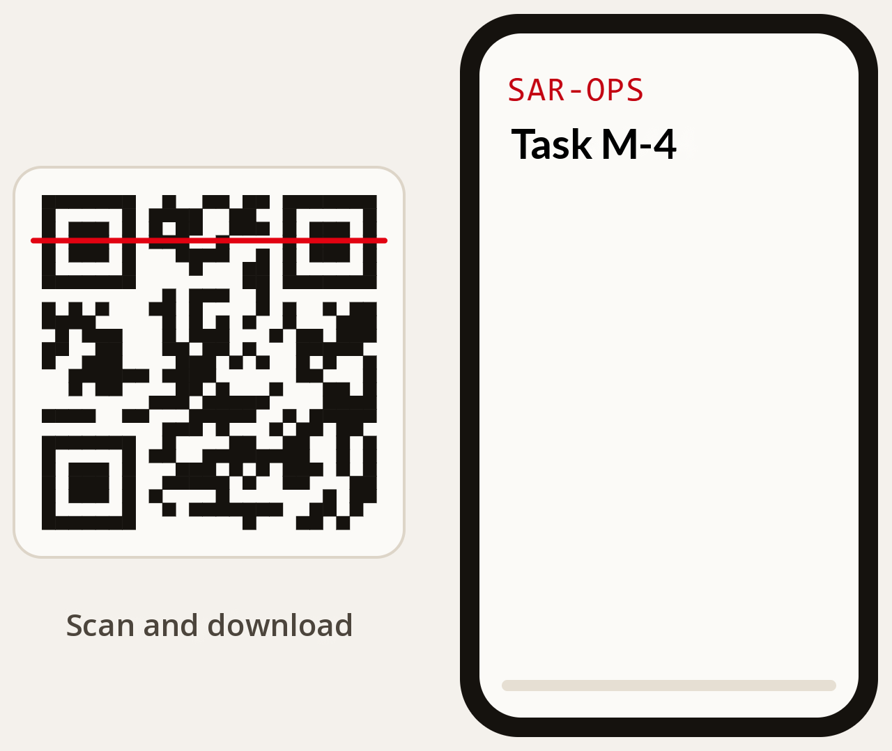
One code. Everything the team needs to know.
The rescuer scans the QR of their task, or receives the link by WhatsApp when they start it, and takes the full dossier on their phone: no account and nothing to install.
01
Task map with its sector or itinerary
02
Photo and reference image of each missing person
03
Description, clothing, vehicle and accompanying animal
04
Medical alerts and expected behaviour
05
ICP location and phone number, and clues already found
06
GPX route for the GPS and, once finished, track upload
WhatsApp carries links, never the dossier. The instructions link expires on its own, so the dossier does not keep circulating afterwards.
SAR-OPS
Step 5 · Deployment
Step 5 · Route and track by QR
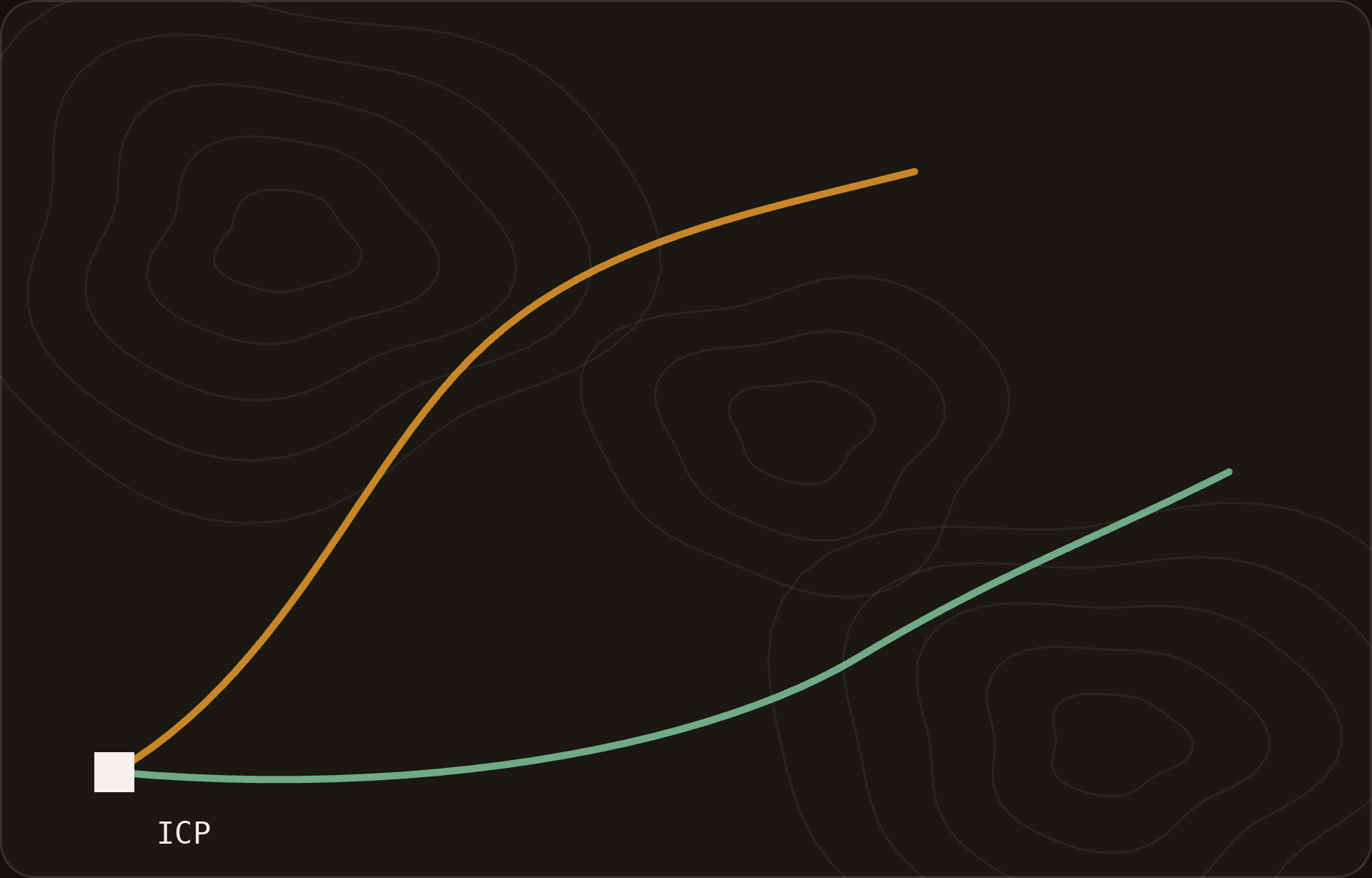
The same QR, there and back.
Scan the QR on the sheet
Download the route for the GPS
Sweep
Upload the track
WHAT THE PAGE SHOWS
The whole task, on the phone
- The task map, with the ICP
- Findings, and clues with their photo
- The tracks already uploaded
- Your position, if you turn it on
WHAT THE TEAM DOES
Download and upload
- Downloads the GPX route for its GPS
- When done, uploads its track as GPX or KML
- While the sweep is open or up to 12 hours later
- Only that phone can delete what it uploaded
The QR printed on the instructions opens the page with no account and nothing to install. Every track stays on the operation map and in the reports.
SAR-OPS
Step 5 · Track
Step 6 · Track the operation
Each task, with its status and its team.
Pending
In progress
Completed
no clues
with clues
victim located
A task is suspended, cancelled or aborted with a reason, and repeated as many times as needed. Its colour on the map changes with its status.
Start
Complete
Suspend
Cancel
Abort
Repeat
Reactivate
EVERY SORTIE RECORDS
Team and number of members
Person in charge and phone numbers
ICP location and phone number
Start and end times
Weather, filled in automatically
Outcome, clues and victims
Part searched, POD and the team's track
SAR-OPS
Step 6 · Follow-up
Step 6 · Coverage priority
Every sweep counts.
WHEN A SWEEP CLOSES
Two questions: how much of the task was searched and, in what was searched, how likely it was to spot the person.
THE LIST REORDERS ITSELF
On top, what is in progress and what has clues. Then by priority: sectors by the probability left per km², routes by what is left to search.
NOTHING TO MEASURE
No measurements in the field, and each task's colour on the map follows its priority. If you change it by hand, it holds until the next closed sweep.
SECTOR S-4 · PROBABILITY THE PERSON IS THERE
AT THE START
From the missing person's statistics
10%
1ST SWEEP
75% searched × 60% chance to spot → POD 45%
5.5%
2ND SWEEP
All searched × 50% chance to spot → cumulative POD 72.5%
2.75%
Another sector of the same size still at 8% moves ahead.
SAR-OPS
Step 6 · Priority

Step 6 · Clues and findings
Every finding is kept on the map.
With its type, date and time, and the task that found it.
Object
Something related to the missing person
Trace
A footprint or a sign of their passing
Witness
Someone says they saw them
Biological
A biological sample
When new clues arrive, SAR-OPS prompts you to review the last known position and the last sighting. And every located victim is kept with their location and status.
SAR-OPS
Step 6 · Clues
Step 6 · Close the operation
When you close it, the report is already written.
Of the operation
Victims, reporting parties, tasks, the full map with the teams' tracks and the day-by-day timeline, with each victim's profile as an annex.
Of each task
Area or route, and every outing with its team, times, weather, what it found, its POD and its track.
Of each missing person
The full profile, with photo, ready to hand over or to file.
Task instructions
The dossier the team takes with them by QR or WhatsApp, with its route as GPX.
All in PDF, in the language of whoever downloads it and in their local time.
SAR-OPS
Step 6 · Reports
Archive and administration
An organized archive, under control.
OPERATIONS PANEL
ACTIVE
Operation Collado Norte
2 victims · 1 found alive
6 tasks · 2 in progress
ID, name, place or victim
Date range
Status
Victims' status
Person in charge
Active tasks
Every closed operation stays available, with its map, its tasks and its reports.
ADMINISTRATION
Users and administrators
Each user sees their own operations; the administrator sees all.
Accounts that deactivate instantly
And their open sessions are closed on the spot.
Operation handover
If someone leaves the team, their work moves to another account.
Audit log
What was done to each account, by whom and when.
Key figures at a glance
Users, operations, tasks and victims located.
SAR-OPS
Archive and administration
Access
Works wherever the team is.
A web app you install like an application: nothing to look for in a store, and the same version for everyone.
At the command post
Install it from Chrome, Edge or Safari and it opens in its own window, no digging through tabs.
On mobile
Add it to the home screen. Field teams only need the QR or the link, no account.
One-week sessions
A search lasting several days won't log you out halfway through the work.
In your language
Interface and reports in Spanish, English and Catalan, each user in their own.
SAR-OPS
Access
Reliability and security
Built not to fail in the middle of a search.
IF SOMETHING FAILS
If OpenStreetMap doesn't respond
It tries another server or generates the minimum tasks, and alerts you.
If an update goes wrong
It rolls back to the previous version on its own, with nobody stepping in.
Over 2,900 tests
Automated: no change reaches the application without passing them.
SECURITY
Servers in the EU
Hosted in Frankfurt, with administration closed off from the internet.
Revocable sessions
Changing the password closes all open sessions.
Encrypted connection
HTTPS and signed links; the instructions link expires in one hour.
SAR-OPS
Reliability and security
SAR-OPS
Shall we try it on a real operation?
We show you SAR-OPS from start to finish with a complete case, and test it with your team in a pilot.
01 · DEMO
A complete operation
Registration, profile, area, tasks, QR, tracks and report, live.
02 · PILOT
With your team
You use it in your operations and tell us what's missing.